


The Hexagon Power Portfolio 2020 release improves collaboration, insights, and results for geospatial professionals. With the release, important features have been added to the ImageStation® software suite, which enables digital photogrammetry production workflows, including project creation, orientation, and triangulation of aerial and satellite imagery.
Let’s take a closer look at some of the new features.
New Blockwise Tie Point Matching and Enhanced Bundle Adjustment for Satellite Data
ImageStation Automatic Triangulation (ISAT) now has automated tie point matching and point editing for satellite projects. This is intended for projects without stereo coverage and for ortho production. This new feature increases productivity in the orientation process and therefore ortho production as well. The option is available from the Select Project and Blocks dialog when accessing Photo Triangulation eXtreme (PhotoTX), or accessed from the Triangulation Options dialog from within PhotoTX.
Previously, ISAT did not support adjustment of multi-segment satellite scenes with non-parallax points matched along a single scene between segments. PhotoTX was enhanced in the release to support the adjustment of these multi-segment blocks after automatic point matching, which is built into the same process. The Point Stats tab now has options to Withhold, Reinstate, and Delete point measurements. Previously, users had to use Multiphoto Orientations or PhotoT to perform point editing.
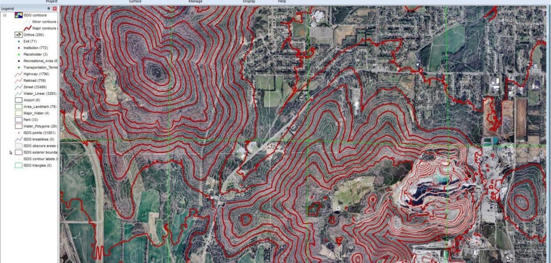
Enhancements to GIS-based DTM Collection and Editing
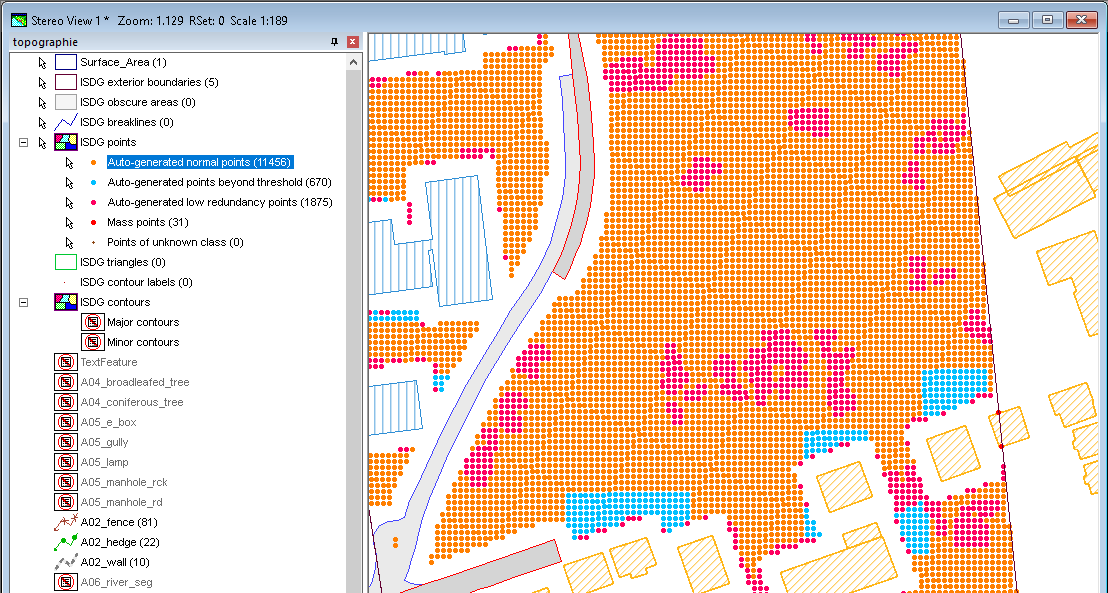
With the release, the DTM file format was modified to store the classification of points. Points can be classified as auto-generated normal, out of threshold, low redundancy, mass point, or unclassified. The ImageStation Automatic Elevations (ISAE) application was modified to write the new format, and the ImageStation Stereo for GeoMedia (ISSG) and ImageStation DTM for GeoMedia (ISDG) applications now recognize the point classification and use it to properly color-code points on display to highlight areas that need to be edited, update the classification after editing, and save the classification back to file. A style library is now delivered by ISDG so that users can customize the display of point, boundary, geomorphic, and contour features in the map and stereo windows in our GeoMedia GIS solution.
Two new commands were also included in ISSG: Generate Uncollected Points and Collect Points. These commands allow users to create a user-defined grid of points and perform operator-assisted manual collection, which can then be used with ISDG commands to generate surfaces. The stereo cursor is driven by the elevation of previous points collected or by using a (coarse) surface.
Create Mosaics Faster and With Higher Compression
The mosaic process was converted to 64-bit and can mosaic images up to 14 times faster than the previous release. The Rectify and Mosaic operations in ImageStation OrthoPro (ISOP) can now directly output Enhanced Compression Wavelet (ECW) files in addition to TIFF, BigTIFF, JPEG 2000, and USGS files.
Previously, creating ECW files required additional software and a separate conversion step. Use of ECW format can compress imagery to 5-10 percent of the original size, while remaining visually lossless. While both Rectify and Mosaic can now directly output ECW files, this is only recommended for the final mosaic for speed and quality. Timing tests comparing ECW output with JPEG 2000 output were conducted and showed faster processing (2x), and higher compression with ECW output.
Smoother Roam Performance Means Less Operator Fatigue
Smooth stereo roam is important to reduce operator eye fatigue during stereo compilation. A number of factors affect roam performance, including the operating system, graphics card, graphics driver, monitor, and application software. Providing the smoothest possible roam in ImageStation has always been a priority. An in-depth analysis of roam performance was conducted, and several improvements were made in the release.
As part of this effort, a new Roam Parameters command was added to both ImageStation Stereo Display (ISSD) and ImageStation Stereo for GeoMedia (ISSG). The command allows users to adjust various settings associated with roam mode operations and calibrate the processing for special system configurations. The default settings are optimized for a variety of units tested at Hexagon.
Although general roam performance, and roam performance when placing linear features, was improved, roam performance when placing complex cell or symbol features with ImageStation Feature Collection (ISFC) can result in reduced roam performance in ISSD. To address this, the new fc point dynamics off key in command was added to ISFC to disable the display of dynamic vector data when placing cells and symbols, allowing for smoother roam when moving between features to be mapped.
See What Else ImageStation 2020 Has to OfferThere are many other exciting features in the ImageStation 2020 release, including more Bentley platform support such as for Power InRoads V8i and Power GEOPAK V8i, 4K monitor support, additional input device support, and more!
You can read more about the ImageStation 2020 launch in the release guide. ImageStation is part of the Power Portfolio’s Producer Suite, which allows users to collect, process, and analyze geospatial data so they can produce meaningful insights. For more information on Hexagon products and services, please visit our website.
