


 About the Author: Patrice Lemire About the Author: Patrice Lemire
Patrice Lemire is the founder and CEO of Geosystems France. Trained as a hydrographer, he acquired extensive experience in bathymetry, topography, and photogrammetry within the French Navy. He joined Leica Geosystems in 2001 as a Photogrammetry Support Engineer. In 2006, he founded Geosystems France to distribute ERDAS photogrammetry and remote sensing solutions in France and in French-speaking African countries. Patrice is fond of innovation and is pleased to diversify Geosystems France activities’ by developing service-based solutions such as F3D. |
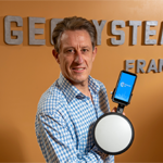
I sat down with Richard Liso to ask him a few questions about FOUILLES 3D (F3D), a comprehensive solution from Hexagon partner GEOSYSTEMS France. Built with Hexagon technology including M.App Enterprise, F3D lets users conduct surveys, stake out trenches, and create reports with full autonomy.
Liso is head of the topography and project unit and innovation referent at Eurovia, Routière des Pyrénées, a subsidiary of Eurovia Midi Pyrénées. Routière des Pyrénées specializes in roads and miscellaneous networks, earthworks, soil treatment, design, and urban development and recently implemented F3D to georeference its utility networks.
What’s the biggest challenge with georeferencing?
The main issue for public works companies is providing centimetric georeferencing in order to comply with French regulations. Until now, this was impossible without mobilizing a surveyor-topographer on site. This entailed travel costs, as well as the implementation of complex site planning and the monitoring of the survey.
So, we needed a simple and versatile solution usable by the field crew. We wanted to make them do the georeferencing themselves. We also wanted to save time for our surveyors so that they could devote more time to the optimization part of our projects.
The idea came to me to do photogrammetric surveying by using a smartphone coupled with a GPS antenna. During an exhibition, I met GEOSYSTEMS France, which was already working on a prototype.
How is F3D used by the Routière des Pyrénées, and what do your teams think of it?
Today, F3D is used on all our sites, and it was quickly adopted by our teams after a very short training course. In fact, they are asking for the tool as soon as they prepare their projects.
We have taken a further step toward empowering our field crews by acquiring the Zeno Mobile Add-on for stakeout and marking picketing. Taking advantage of the versatility of the Leica GG04+ GNSS antenna, they can set up and maintain the marking and picketing of existing utility networks. They can transmit the layout file directly through the smartphone’s messaging system.
We are currently in the test phase to perform the maintenance of existing networks through Augmented Reality.
What are the benefits of using F3D?
The most obvious and quickest benefit is the planning simplification. Our field crews are much more autonomous in their tasks, as they can carry out the stakeout and georeferencing alone. As a result, our surveyors no longer waste time traveling, and we can maintain the quality of the measurements taken with the antenna.
Overall, thanks to F3D, the projects are executed much faster; I can save about four days per month!
How would you summarize F3D’s impact on your business?
Clearly, this is a solution in line with the requirements and regulations regarding georeferencing accuracy. It was really easy to optimize our processes and realize savings while improving the quality level of our services.
To learn more, watch the video:
