 About the Author: Patrice Lemire About the Author: Patrice Lemire
Patrice Lemire is the founder and CEO of Geosystems France. Trained as a hydrographer, he acquired extensive experience in bathymetry, topography, and photogrammetry within the French Navy. He joined Leica Geosystems in 2001 as a Photogrammetry Support Engineer. In 2006, he founded Geosystems France to distribute ERDAS photogrammetry and remote sensing solutions in France and in French-speaking African countries. Patrice is fond of innovation and is pleased to diversify Geosystems France activities’ by developing service-based solutions such as F3D. |
FOUILLES 3D (F3D), a solution for direct georeferencing and verification of open trench networks, has passed France’s Utility Network Localization – Georeferencing certification.
The certification was provided on November 24 by the Association Française de Normalisation (AFNOR), the French national organization for standardization.
The French government requires that all critical underground utility, including buried electric power cables, pipelines, and public transport infrastructure, be georeferenced in centimetric accuracy for safety reasons. The Routière des Pyrénées, a subsidiary of Eurovia, specializes in roads and miscellaneous networks, earthworks, soil treatment, design, and urban development; it implemented F3D to accomplish the task.
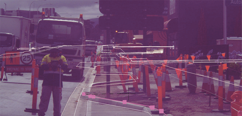
F3D, a comprehensive solution for the direct georeferencing, stakeout, and verification of open trench networks from Hexagon partner GEOSYSTEMS France, allows users to visualize buried networks in augmented reality. Built with Hexagon technology including M.App Enterprise, F3D also lets users conduct open trench surveys and create reports fully autonomously.
With F3D, the AIPR-certified site field operators — those authorized to work on utility networks — can now georeference networks directly by scanning the trenches, without the on-site intervention of a surveyor-topographer.
At the office, the surveyor-topographer receives the survey report and checks the quality of the georeferencing and validates or invalidates the trench backfill. This saves travel time and allows the surveyor-topographer to focus on quality control and project implementation.
A year of experience, feedback from operators, methodological development, and technical improvement went into making F3D as functional and valuable a tool as possible. As a result, everyone benefits — in addition to saving surveyor-topographers time and simplifying planning, F3D also enhances the skills and expertise of site managers and surveyors.
Watch the video to learn more.


