


I’m a computer science master’s student at Bundeswehr University Munich, which is affiliated with the German Armed Forces. During my six-week internship at Hexagon’s office in Munich, I was tasked with exploring the potential of utilizing low-resolution satellite imagery to assess changes in specific areas. Here are the discoveries I’ve made.
Having up-to-date maps is crucial to mission planning, and this holds true beyond just military applications. The Multi-national Geospatial Co-production Program (MGCP) was established with this goal in mind and “is a coalition of over 30 countries dedicated to producing high-resolution topographic vector data throughout high interest areas of the world,” with each country responsible for a defined area.
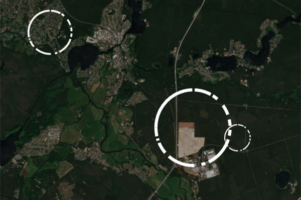
Grünheide on June 20, 2020.
High-resolution satellite images used for updates are associated with significant costs and limited temporal resolution. However, developing a dependable method to utilize low-resolution satellite images for initial assessments could significantly enhance the overall process.
Change detection involves measuring how attributes of an area have evolved over time using aerial photographs or satellite imagery. Its applications span a wide range, including monitoring deforestation, tracking urban growth, assessing the aftermath of natural disasters and more. The reliability of change detection results is intricately linked to the quality of the data used during analysis.
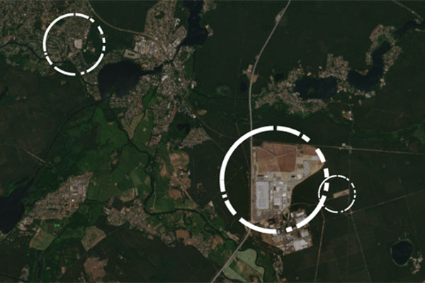
Grünheide on June 5, 2023.
In my research, I utilized freely accessible satellite imagery sourced from the Copernicus Sentinel-1 and Sentinel-2 satellites, along with Hexagon’s ERDAS IMAGINE remote sensing software. This analysis concentrated on the Grünheide region near Berlin, Germany, and I explored three distinct methods for detecting changes in images: object detection, image difference and image segmentation.
Change detection methods vary depending on the approach. Object detection identifies larger objects, such as airports and lakes, by selecting possibilities from the MGCP symbol list and tracking them over time, which may lead to missing smaller objects. Image difference detects changes by comparing pixel values between images but can be sensitive to color variations. Image segmentation divides maps into zones, like built-up areas and vegetation, to track changes between categories over time. Each method provides unique insights into change detection.
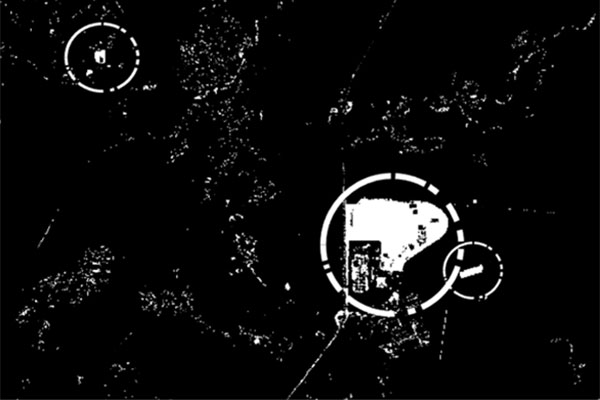
With ERDAS IMAGINE, the user can implement CVA, change the magnitude map and change the threshold map.
Given the low resolution of the images, I determined that object detection was not a viable option for initial assessment. Conversely, both image difference and image segmentation yielded promising results and appeared valuable for a comprehensive evaluation of the region. It turned out that linking them with KPIs (percentage of changes within the given spatial extent), the method can be used to identify changes in time justifying the buying of higher quality imagery for updating the map. As such, it is a good initial step to reduce costs and increase speed when fulfilling the promises made to the participating countries.
Explore our defense solutions and learn how they transform complex data into meaningful information necessary for informed, mission-critical decision-making.
