


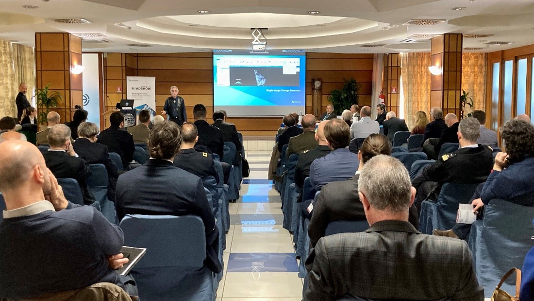
Hexagon’s Safety, Infrastructure & Geospatial division hosted a series of roadshows this year with the intention of providing defence-focused companies and agencies with an opportunity to discuss the topics important to them in a relaxed and productive forum. Each of the four roadshow events featured an engaging and interesting agenda of partner and industry experts presenting use cases, trends and product details that gave the audience food for thought. This year, we held events in Italy, Poland, Spain and Turkey.
One topic of interest for all attendees was Emerging Disruptive Technologies (EDT) in defence. As a technology company, it’s paramount that Hexagon makes technological advancements to benefit users. But not all innovation is new; it can also involve taking an existing capability and applying it to different use cases. The roadshows gave us a great opportunity to introduce existing users to different software and solutions to improve cross-agency innovation. You can read more about EDT in defence in a whitepaper, The future of defence: Which technologies to watch.
GeoINT applications
Each roadshow’s opening presentation was given by Vincent Rifici, our director of defence for Europe, the Middle East, Africa and India. He highlighted the value of Earth Observation (EO) services in defence and emphasised the fact that a single data set often has multiple uses and can help decision-makers gather information, often in conjunction with other data sources. The use of location —GeoINT — in time and space (i.e., “where” and “when”), is key to understanding relationships between the physical, social, economic and military elements that contribute to a situation. Analysing diverse, complex data sets linked by geography produces certain indicators that better inform users. An example is using OSINT and multitemporal EO, such as IMINT, to identify patterns in vehicle and human traffic around defence establishments.
One EO data source mentioned in numerous presentations was SAR, Synthetic Aperture Radar. With its ability to see through clouds and the dark of night, emphasise metallic structures, detect small changes to a surface, generate elevation data and identify objects, SAR is a valuable defence asset. But it’s not easy to interpret natively. Derrold Holcomb, an advanced sensor software manager at Hexagon, explained that software tools are key to exploiting this data. The ability to detect change within one single image is a new capability, so for defence, showing if a vehicle has moved without having to wait for another SAR image is a huge advantage. Using the abilities of modern computers to produce real-time enhancements and analysis of the SAR imagery means users can create reports much sooner than was previously possible.
Creating an air picture
Moving down the atmosphere, we discussed the air domain for both manned and unmanned aircraft. For defence of military interests and critical infrastructure, the detection of small UAVs is key to disabling threats. Visualising the combination of 3D airspaces, flight tracks and sensor feeds such as radar in a geographic view creates an air picture and situational awareness around an area or place of interest. With sensor and geographic alerts, such as three-dimensional no fly zones, users can concentrate on real, confirmed threats rather than having to monitor many potential threats.
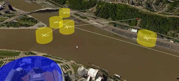
Real-time aircraft tracks visualised along with protected airspaces
We talked about planning sorties for both manned and unmanned aircraft, often with solutions focused on certain aircraft due to differing capabilities and characteristics. Again, integration of defence data, such as aviation charts, vertical obstruction data and terrain data, was highlighted as a key to planning safe routes.
In addition, we covered using geographic data to debrief and report post-mission. Past, present and future data in terms of recorded tracks, current weather feeds and planned aircraft locations can be visualised and analysed together, for example. Differing scenarios can easily be played back on the base of real-world geographic data.
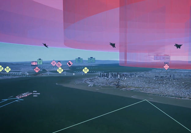
A combination view of land and air assets with full support for military symbology
The roadshows would not have been truly topical without live demonstrators of AR and VR for defence use cases. With applications for both Oculus Quest 2 and Microsoft Hololens 2 built by Saurabh, using Hexagon’s Luciad technology, there was plenty to discuss relating to the applicability of these technologies in defence.
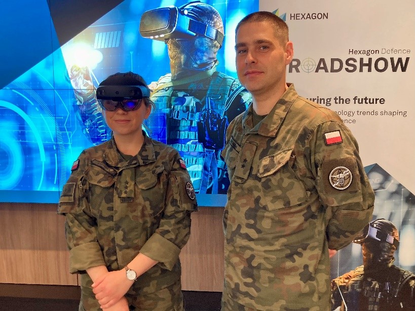
Trying out the AR headsets
Of particular relevance to many attendees was the topic of geospatial data within digital twins, and how these can become digital realities — where real-time data is included and the virtual representation can be used operationally. Unlike virtual reality or simulations, which are usually divorced from the real external world, digital twins model real-world assets with sensors that continuously update the twin with granular, high-quality information — hence digital reality. Deep learning can be used on edge devices to send just alerts or anomalies to the digital reality, lessening the cognitive burden on defence decision makers and analysts. For digital realities, having software solutions that help solve digitalisation and integration challenges is key.
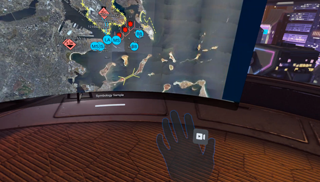
An example C2 application, viewed within Oculus VR headset
Alongside single-domain solutions for land, air and maritime, several partners presented on Multi-Domain Operations (MDO). MDO is the synchronisation of air, ground and maritime forces, vehicles, satellites and their systems and sources of data. This delivers a complete battlespace picture with the intent of enabling quicker decision making. With MDO, it’s possible to include even more data and information in situational awareness and digital realities. The key is to transform complex data into the meaningful information necessary for informed, mission-critical decision making. Working with industry and open standards for data and information exchange helps with this, as does automation of tasks. Some roadshow presentations included examples of automation for object tracking, change detection around foreign military facilities and perimeter intrusions.
Looking toward the future
The future of military operations will encompass the six domains, with close relationships and interdependencies between them. Using GeoINT as an information source and reference base for the domains and information will ensure that decision makers are seeing and using the same source of truth — fighting off the same map.
It was our hope that the roadshows would invigorate users around defence with technology and ideas. From the discussions at the events, that objective was accomplished: Among the user feedback were phrases like “very interesting” and “glad to attend the event.”
We visited a variety of countries, speaking in different languages and interacting with a range of attendees, but it was clear that the defence industry faces common issues around the world. Fortunately, that means developing a solution for one difficulty often solves multiple problems. We’d like to thank our partners, colleagues and the organisations with which we collaborated for making these events a success. We look forward to engaging in future roadshow events and tackling the obstacles of the future — together.
