While clear skies and forecasts play a major role in safe aviation operations, situational awareness closer to the ground is also critical.
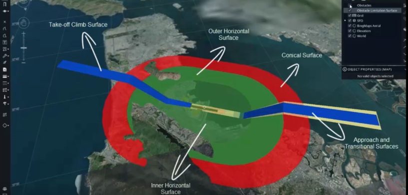
That’s where obstacle limitation surfaces (OLS) come in. This key concept, defined by the International Civil Aviation Organization (ICAO) for Airport Clearance Management, aims to ensure the safety of aircraft operations. With an OLS, ground control managers can visually analyze plane takeoff and landing clearances in 3D to ensure safe operations.
In addition, air navigation service providers (ANSPs), airports, and local authorities can use an OLS to check whether a construction project is safely outside the necessary parameters to avoid the possibility of collisions.
OLS Analysis with the Luciad Portfolio
In the prototype below, LuciadLightspeed supports loading electronic terrain and obstacle data (eTOD) through a wide variety of digital terrain and aviation data formats such as AIXM 5.1. It also takes into account the elevation surface and the OLS according to ICAO Annex 14 standards and incorporates Bing Maps as background data.
3D meshes and out-of-the-box 3D shapes available in the LuciadLightspeed library are used to create the OLS surface. The user can drag and drop any 3D obstacle, and the eTOD tool checks dynamically for collisions between the obstacle and the OLS and updates the styling accordingly as the user moves the obstacle.
See for yourself how LuciadLightspeed can support Airport Clearance Management with dynamic OLS visualization.


