


On any given day, 70% of the Earth’s surface is hidden by cloud cover. Clouds may bring joy to the masses by giving much needed shade on a hot day or creating interesting shapes for imaginative children. However, imagery obtained by satellite sensors is constantly constrained by clouds blocking the view of the surface of the Earth and their shadows obscuring or distorting features on the ground. Often, the imagery is unusable for it’s intended application due to the cloud obstruction.
Enter our long-time partner GEOSYSTEMS GmbH who created a suite of six Spatial Models, called IMAGINE NoClouds, to rid imagery of clouds, cloud shadow, and haze from Sentinel 2 and Landsat 8 data. Now, with the push of a button, all compromised pixels including clouds, cloud shadows, and haze can be easily removed using Smart Mosaicking, leaving only pure information for your imagery exploitation.
Why did they do it? Satellite imagery analysts need current information, they need to be able to identify features on the ground, and of course, they rely on time series data in order to preform change detection analysis. Cloud cover is a common problem when trying to exploit information form satellite imagery, and the technology to remove the cloud cover was complicated, cumbersome, and didn’t yield good results. So, GEOSYSTEMS set out to build a system that makes it simple and automatic while delivering consistently cloud-free images.
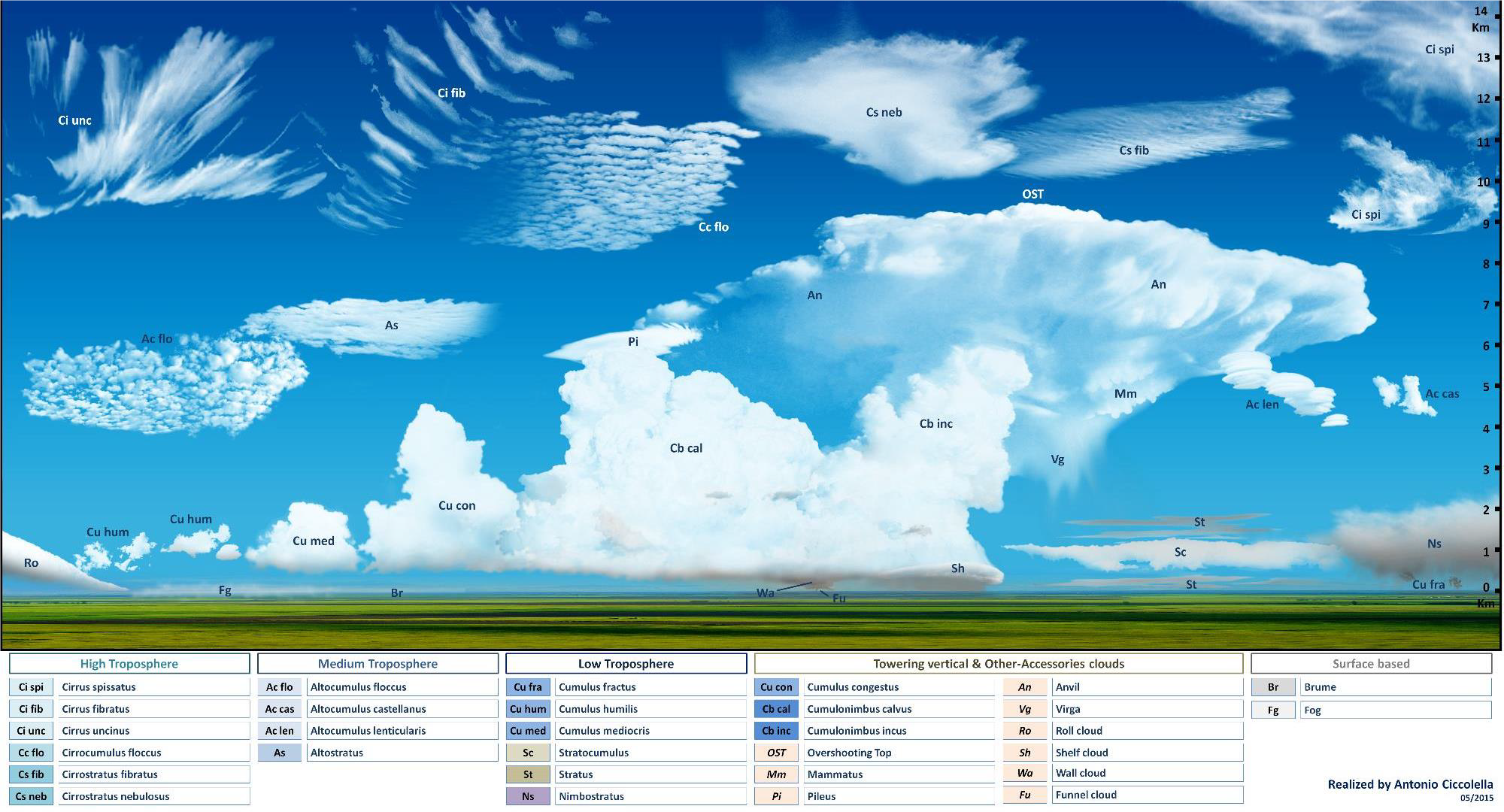
How did they do it? First, they had to understand everything that would encompass this undertaking. Clouds are not always nice, fluffy blobs that are easy to identify. Most cloud cover includes many cloud types, haze, snow, and shadows with different levels of transparency. Using the Spatial Modeler provided with ERDAS IMAGINE, they began their sophisticated spatial model with Model 1 by creating parameters for cloud and shadow mapping using spectral bands, band ratios, and adapted texture parameters.
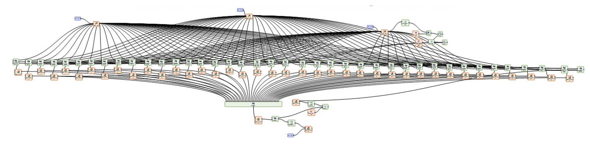
Spatial Modeler allows subject matter experts who are not programmers to create and apply geospatial processing algorithms to solve specific problems. These models can be shared within the organization or (as in the case of GEOSYSTEMS) a third-party solution available for purchase. IMAGINE NoClouds Model 2 identifies 80 cloud classes and includes most haze and snow. This was not a simple task. Below is the visual representation of the Spatial Model created to support the identification parameters for Model 2.
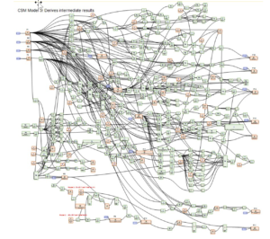
After creating Model 1 and 2, GEOSYSTEMS was pleased with a reasonably good cloud mask, but they still had not addressed many cloud-related problems that can occur in imagery. Model 3 uses several auxiliary parameters to derive shadow expectation zones, separate snow from clouds, and resolve other cloud-related imagery problems that are difficult to solve. Below is the resulting spatial model.
Now it’s time to find the shadows. Model 4 defines shadow candidates, completes object-based analysis for determining final shadowing for removal, and separates shadow areas from bodies of water. Model 5 selects the final cloud candidates for removal with cloud selection or deselection based on object analysis. The result contains even the most opaque and semi-transparent clouds. Finally, Model 6 identifies any remaining haze, clouds, and their shadows, captures clouds over water, separates ice-clouds from snow on the ground, and applies buffers and final filtering.
No Clouds in the Imagery: What’s Next?
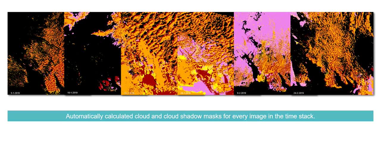
Now that all of the clouds, the haze and the shadows are removed, how do we fill in those empty spaces with cloudless pixels for a finished, functional cloudless image? In the seventh and final step in the process, IMAGINE NoClouds calculates cloud masks using up to eight Sentinel-2 images of the same geographical area taken on different dates within a two-week period. The algorithms performing these functions are very advanced including radiometric adjustment in order to produce a homogeneous cloudless image. NoClouds is essentially looking for undisturbed data in these other images to patch the spaces creating a full, cloud-free image.
See IMAGINE NoClouds in action:
To use GEOSYSTEMS’ IMAGINE NoClouds add-on, a current ERDAS IMAGINE license is required. Ready to get started? Contact us for pricing details.
Learn more about our partner GEOSYSTEMS.
