Marti de las Heras and Bego Verdejo
Open data – making data openly accessible – is a global movement promoted by public administrations with the objectives of making the most of available public resources, being transparent with information generated or guarded by public bodies and allowing access and reuse of that information for the common good and benefit of interested persons and entities.
This public information, of great potential value, can be related to any subject and of any type – pictographic documents, statistical data, results of studies or analyses, public services information, etc. Companies, researchers, public institutions or the general public can make use of information resources for any purpose, maximizing the economic and social possibilities of open data: promoting transparency, improving services, generating business activities and social impacts and increasing efficiency in governance.
Geoservices and open data
The need to create geoservices infrastructure is driven by the demand for internal and external management of territorial information interoperability.
Internally, governmental bodies such as city councils generate and employ large amounts of georeferenced data, and there are more and more municipal management applications that require the cartographic component to be able to access the cartographic information managed by the various municipal technical departments so that it can be combined and used.
On the other hand, external demand comes from professional groups, municipal services companies and utilities that use the cartography prepared and maintained by governmental bodies as a starting point in their planning, updating and consultation of the territory. At the same time, efforts are being made to promote the implementation of interoperable cartography. Public cartography can be used by service companies and can be improved with their own data to be more useful for their needs.
Therefore, one of the main objectives is to improve control operations and relations with external contractors, combining the cartographic information of the companies’ management with external companies’ and contractors’ own information.
Real-world example: Barcelona City Council Geoportal
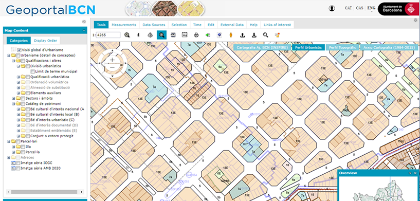
The cartographic infrastructure of the Barcelona City Council’s Barcelona Territorial Information System (SITEB) includes management, planning and services data, as well as urban planning, roads and administrative divisions data, cadastral data and topographic elements. Barcelona’s spatial data infrastructure (SDI) is fed by existing entities in the information system.
The Geoportal and web services for Barcelona City Council’s IDE allow municipal territorial information to be made available through the web using Open Geospatial Consortium (OGC) standards. The purpose of the Geoportal is to offer users access to a series of resources and services based on geographic information. It allows the discovery, access and visualization of geospatial data, using a standard browser, and enables the integration, interoperability and exchange of information between various institutions, professional groups, service companies and more.
The Geoportal complements the cartographic services already available on the Barcelona City Council website: the Citizen’s Guide and urban plans.
Learn more about the Barcelona City Council’s Geoportal.


