


In the Himalayas of Nepal, the increased depletion of glaciers has caused reserves of glacial ice to transform into glacial ponds and lakes, some containing millions of cubic meters of water. The change in the way this freshwater is stored has had a measurable effect on water availability in the small villages that populate the downstream region.
The larger glacial lakes have the potential for burst and to form what are called glacial lake outburst floods (GLOFs), which could destroy infrastructure, agricultural land and so forth in the villages below. The lakes must be monitored frequently by researchers to better understand how they develop into potentially dangerous floods and to create disaster management protocols in case a flood occurs.
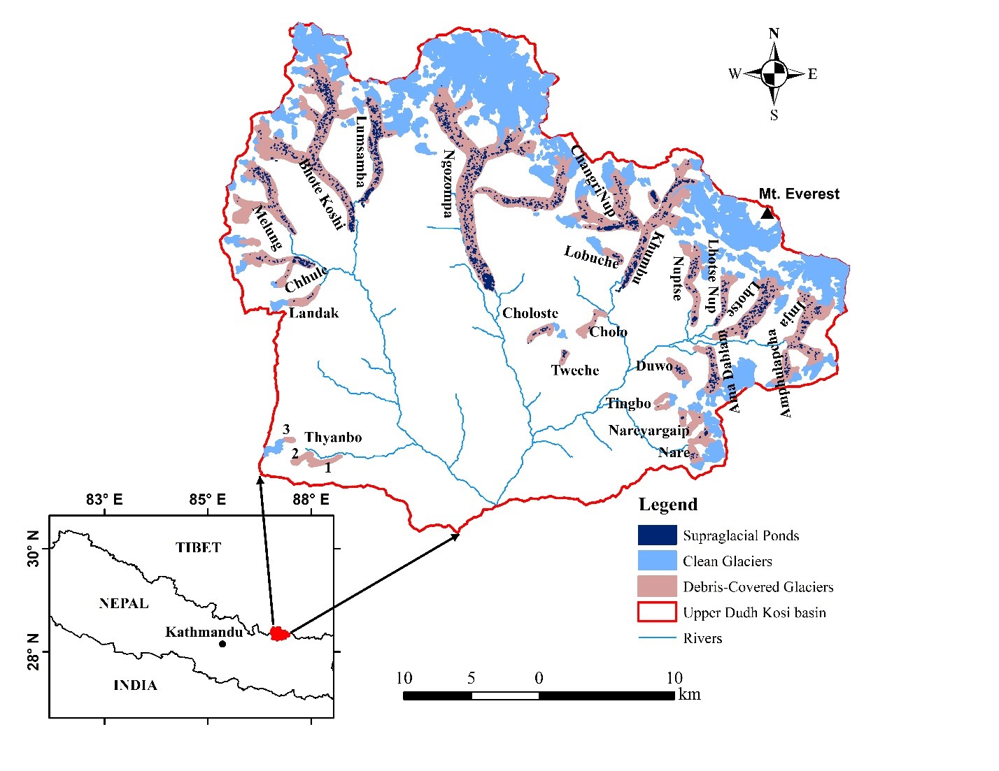
Mohan Bahadur Chand, an Environmental Science PhD student at Hokkaido University in Japan, is studying the development of supraglacial ponds, or those forming on the surface of a glacier, in the Nepal Himalayas. Mohan aims to present a survey of the historical development of supraglacial ponds that includes high-accuracy information collected on an annual basis from 1989 to 2018.
Mitigating the Effects of a Warming Climate
Mohan’s main objective is to understand how the Himalayan Glacier has responded and will continue to respond to an increasingly warming climate. He hopes these studies will help minimize the hazards from the GLOFs and generate interest in preventative measures for water and disaster management.
Together with images from the DigitalGlobe Foundation and free images from the U.S. Geological Survey’s Landsat and the European Space Agency’s Sentinel-2 satellite missions, Mohan used the remote sensing capabilities of ERDAS IMAGINE to propel his research. He selected twenty-three debris-covered glaciers, which make up 88 percent of the total glacier cover in the Sagarmatha (Mt. Everest) National Park, as the study area.
Mohan began by preprocessing the satellite images, which needed radiometric and geometric correction. Using the rapid atmospheric correction and orthorectification tools available in ERDAS IMAGINE, Mohan was then able to mosaic the images of the glaciers. He used the Normalized Difference Water Index algorithms and band ratio techniques to map the supraglacial ponds for understanding change detection of the time period. He later felt that in situ measurements could improve the results significantly, so he visited two glaciers in the Everest region to collect data with Unmanned Aerial Vehicles (UAV) and GPS, generating a map that would help estimate the size of the ponded area.
The Results: Significant Increase in Glacial Waters
His results demonstrate a continuous increase in both the number and the size of supraglacial ponds in recent decades in the Everest region. He determined that the area will require regular monitoring of the ponds and lakes, field-based measurements that also involve bathymetry, and more research on the morphological characteristics of the surroundings.
Spillway lakes and associated ponds near the terminus of glaciers are also growing exponentially, which indicates a measurable trend towards even larger glacier lakes in future. Take a look at the Sensing Change Blog to see more research from students in Hexagon’s Geospatial Division’s Education Program.
