


Government officials across the globe face a number of geospatial challenges: creating seamless mosaic maps of entire countries, compressing spatial data to reduce storage costs, and serving the imagery even across low-bandwidth internet connections.
As the seventh largest country in the world by area (3.8 million square kilometers), India boasts an extremely diverse landscape. From the Himalayan mountains, the Indo-Gangetic Plain, and the Thar Desert to Indian Ocean coastlines and densely populated cities along India’s three major rivers, providing maps and geospatial data for such varied geographical regions presents a tremendous challenge.
“It has been a herculean task,” said Dr. Vijay Veer, Scientist-F.
National Informatics Centre (NIC) provides map services and is a lead developer of e-governance applications for the national government of India and different departments of state governments across the country. In 1996, NIC established a geospatial division to carry out innovative projects in the emerging areas of GIS and remote sensing.
Digital Empowerment
To support the Indian government’s Digital India initiative to transform the country to a digitally empowered society, NIC sought to create a national image web service of natural color products and imagery. The major challenges were handling huge file sizes, optimizing cloud storage, and managing and serving the data as an interoperable service on any connection.
With ERDAS IMAGINE Expansion Pack tools, NIC officials georeferenced individual scenes of satellite imagery with the external global services. They then used pan sharpening techniques and ERDAS IMAGINE’s color tool to create a natural color imagery product.
The 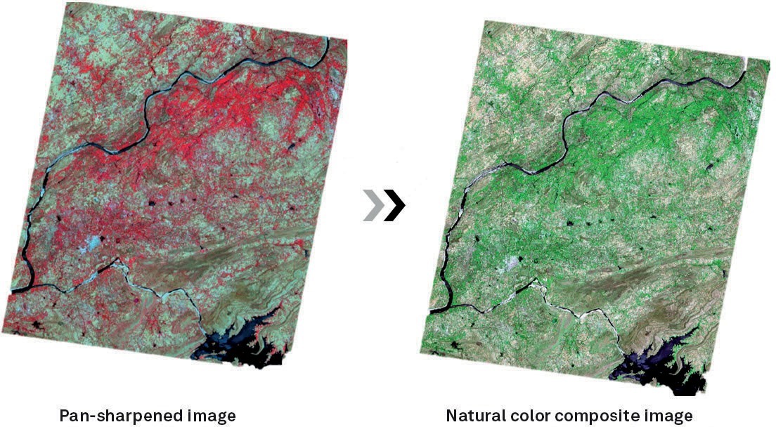 natural color composite (NCC) images were mosaicked and pan-sharpened to the statewide NCCs across India. These mosaics were later joined to create a single seamless NCC mosaic image of the entire country of India through ECW visually lossless compression.
With a fully developed national image web service in place, NIC ensures that state governments and departments across India have access to 5 TB of high-resolution country-wide basemaps rendered with impressive speed, topographic maps, satellite images, and hybrid maps, all aligned to global geospatial standards.
ERDAS APOLLO hosts this national image web service, which is used in various e-government applications and provides citizens with electronic delivery of services for improved planning and good governance. And because it’s OGC-compliant, the service ensures interoperability and ease of integration for visualization, validation, and 1:10,000 scale mapping of GIS data.
By leveraging these technological advancements, NIC turned challenges into opportunities and now provides fast, user-friendly interoperable map delivery to users across the entire country.
To learn more, read the complete case study.
