


In 2003, NATO’s Science for Peace and Security program launched an initiative to enable the worldwide exchange of geospatial data.
The Multinational Geospatial Co-Production Program (MGCP) is part of NATO’s defense sector and involves digitally mapping non-NATO countries. Aerial satellites are the primary source of imagery, but aerial photos, Landsat images, data, and old topographic maps are also sometimes consulted to glean additional information about the area in question.
MGCP is continually updated to keep up with evolving technology. Today’s users demand instant access to data, meaning it must be published and distributed through web services as quickly as possible.
This rapid map production presents a variety of challenges for mapping agencies. Creating maps can be expensive and requires a significant amount of time and labor. In many cases, the demands on a mapping agency exceed its limited resources. Logistical bottlenecks also make it difficult to provide warfighters with up-to-date content in a timely manner.
To fulfill the mapping and charting needs of their stakeholders, national mapping agencies need a solution that meets these challenging requirements. Hexagon US Federal, part of the Geospatial division, has developed the most powerful tool available for the job: Cartographic Web Services (CWS).
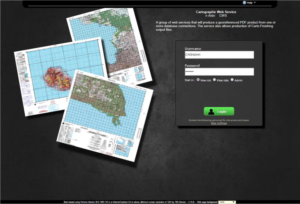
Easy connection through a URL and credentials.
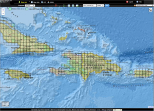
Graphic cell selection chart production.
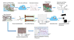
With CWS, the cartographic production process is simple. The user begins by selecting the product or products that are to be generated. CWS allows for single, batch, or automatic production. It produces single (by footprint or area of interest) or multiple (by footprint) sheets through its graphical map-based user interface.
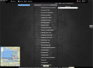
In CWS, batch processes also act as an administrative function where a list of sheets or all sheets in view are selected for processing. For automatic production, CWS’ automatic processing listens to database triggers that cause a new map to be generated when changes occur in the source database; afterwards, the final map is created.
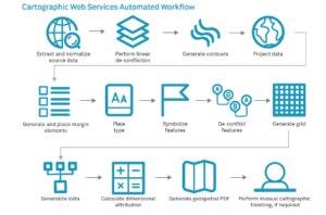
Automatic sequence of steps in chart generation.
CWS consumes your data from OGC-compliant services or data stores. User-defined configuration files instruct CWS in the generation of cartographic products from these sources. Users can select from a variety of outputs, including Geospatial PDF, DCS (if the map is to be finished to that specification), GeoTIFF, CADRG, and Arc Finishing Package (AFP).
The output of the process is an automated map that can be used as-is for specific applications or edited to create either a provisional map or a standard practice map.
Some key statistics:
- A 15 minute × 15 minute 1:50,000 scale map can be produced in an average time of 11 minutes from a source compiled at 1:50,000.
- A 30 minute × 30 minute 1:100,000 scale map can be produced in an average time of 16 minutes from a source compiled at 1:50,000.
- The majority of level 1 maps require about eight hours of finishing to meet the specification
- Maximum density urban maps usually take no more than 40 hours of manual finishing
On the strength of these numbers, the National Geospatial-Intelligence Agency elected to deploy CWS following a rigorous evaluation of multiple automated finishing systems. Now NGA, its customers, and its international partners will have the ability to rapidly generate high volumes of mapping and charting products.
“We’re proud to provide CWS as part of our NGA support as a critical element to the Source Directorate mission,” said Tammer Olibah, CEO of Hexagon US Federal. “It’s an honor to be a partner for NGA as they undertake modernization efforts which are vital to national security.”
CWS provides an easy and automatic workflow for rapid chart production based on web services. It can be accessed through a web browser and allows non-expert users to run batch and asynchronous processes. Learn more about Hexagon US Federal’s cartography and map production technology and how it addresses international standards.
