


In the modern defence landscape, achieving superiority requires more than just collaboration across different services and nations; it also demands integration across multiple domains: land, air, sea, space and cyberspace. This concept, known as multi-domain operations (MDO), is a transformative approach to defence strategy. However, the path to effective MDO is fraught with challenges.
Explore Hexagon’s multi-domain operations capabilities
Defence professionals face several critical obstacles
- Data overload: The volume of data generated across domains is immense, ranging from intelligence reports to live sensor feeds, and making sense of it all in real time is daunting
- Interoperability gaps: Systems and organisations often operate in silos, using different data formats and standards, which hinders communication and collaboration
- Dynamic threats: The pace of modern conflicts requires rapid decision-making, but fragmented data and outdated tools can hinder response times
- Complex visualisation needs: Operators must interpret and act on data from diverse sources, often requiring advanced visualisation to fully understand the common operating picture (COP)
The role of technology in overcoming MDO challenges
To tackle these challenges, defence organisations need technology that is not only powerful, but also adaptable to the complexities of MDO.
The following technological capabilities are essential:
Interoperability beyond standards
Having standard communication methods is crucial for ensuring interoperability and understanding. The standards, provided by the OGC, as well as NATO STANAGs, can be thought of like the basic drills and protocols every soldier learns in boot camp. They make sure everyone knows the same commands and can work together at a basic level. But just knowing the drills doesn’t win battles.
To succeed on the battlefield, you need advanced strategies, specialised equipment and the ability to adapt. That’s what advanced technology does — it’s like having a battle plan and the tools to coordinate every unit seamlessly, no matter their role. It takes all the intel from different teams, combines it smartly and gives everyone a clear, unified view of the mission, unlocking the full potential of data.
Unified situational awareness
A cornerstone of MDO is the ability to combine data from disparate sources, such as nautical charts, satellite imagery and 3D terrain models, into a single, cohesive view. Smart integration allows operators to make informed decisions with a clear understanding of the environment, whether on land, at sea or in the air.
Dynamic data visualisation
Modern conflicts evolve quickly, and operators need tools that can keep pace. Interactive visual analytics enable users to filter, style and interpret live data streams, such as radar plots, air tracks or even social media activity. These tools ensure decision-makers have access to the most relevant and actionable information in real time.
Intelligence integration with NITF
Intelligence reports often come in National Imagery Transmission Format (NITF), which is widely used for storing annotated imagery and detailed intelligence data. To maximise the value of NITF, technology must offer dual capabilities:
- Pixel coordinate access: Gives experts granular control over annotations and image details
- Geo-referenced integration: Enables intelligence data to be viewed in a geospatial context, such as on 2D or 3D maps, for broader situational awareness
By supporting both access methods, technology ensures that NITF data can be used effectively by different user groups.
Hexagon’s solutions for multi-domain operations
Hexagon is a leader in providing advanced technology solutions for defence organisations, with a proven track record of enabling multi-domain operations. Our Luciad portfolio exemplifies our commitment to overcoming the challenges of MDO through innovation and expertise.
Luciad SDK: The engine of integration
The Luciad SDK is purpose-built for MDO, offering unmatched capabilities for data fusion, analysis and visualisation. It supports open standards beyond simple compliance, enabling defence professionals to unlock the full potential of their data. Key features include:
- Hybrid 2D/3D visualisation: Operators can seamlessly switch between 2D and 3D views, gaining a comprehensive understanding of complex environments
- Smart data integration across domains: From land and sea charts to satellite imagery and intelligence reports, Luciad enables the creation of a COP – this entails more than just overlaying all data; it requires understanding of different domains, e.g., aeronautical navigation data needs to fully cover a region, while maritime charts can be restricted to bodies of water
- Real-time analytics: Luciad’s interactive tools empower users to adapt to changing scenarios by dynamically filtering and visualising live data streams
NITF integration for enhanced intelligence
Hexagon’s solutions make NITF data more accessible and actionable. By offering both pixel coordinate and geo-referenced OGC services, Luciad ensuewa intelligence reports can be used by a wide range of users:
- Expert analysis: Operators can inspect annotations and image details with precision
- Operational planning: Intelligence data can be overlaid onto maps, combined with other data sources and used to inform mission strategies
Real-world applications
Hexagon technology has been deployed in various scenarios to enhance MDO capabilities:
- Land and sea integration: Near harbours, Luciad combines nautical charts with land-based data, providing a seamless view of both environments. This is illustrated in Figure 1 depicting a view of a harbour.
- 3D data augmentation: Generally available 3D data is typically updated every few years and does not contain attribute data. This 3D information can be augmented and brought up to date by draping video footage (Figure 2) or OGC map and feature services (Figure 3).
- Multisource data analysis: In the air domain, environmental information is an important factor for safety and efficiency of operations. This requires 3D and even 4D analysis. Figure 4 illustrates the analysis of environmental conditions within a requested airspace for training flights. The red colouring indicates areas sensitive for formation of contrails.
Interoperability and the enablement of interaction is only one of the technology aspects of multi-domain operations. For a more comprehensive background on how to achieve MDO and how Hexagon technology enables you to developer powerful solutions, read our white paper.

Figure 1: Operational view of a harbour, constructed from a smart combination of maritime charts, satellite imagery, road network data and 3D building and infrastructure data
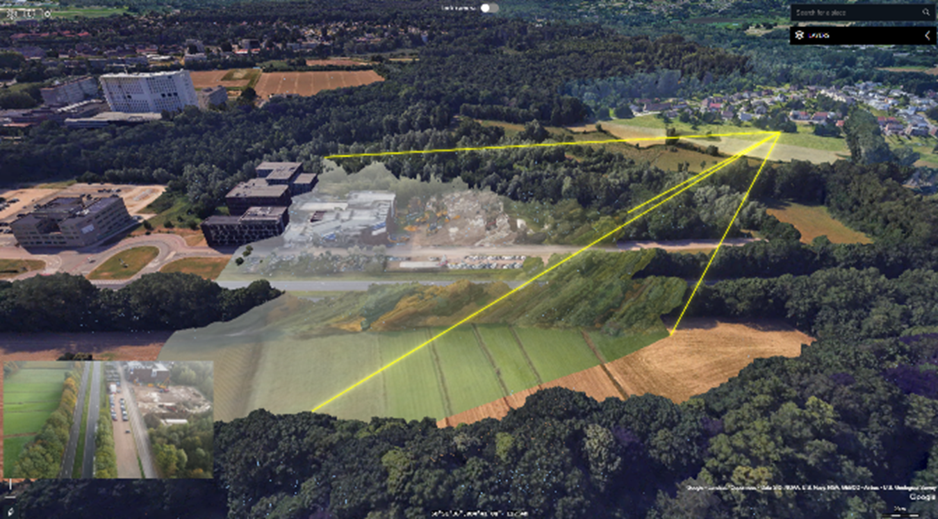
Figure 2: Update 3D city scans with real time situation updates by draping drone video over the 3D meshes.

Figure 3: Augment 3D city scans with up-to-date cadastral or administrative data by draping OGC feature services over the 3D meshes.

Figure 4: The 3D and 4D analysis of airspaces, planned flights and environmental conditions play a key role in improving the safety and efficiency of air operations. This screenshot is from a demo application built with Airbus Defence and Space.
Explore Hexagon’s multi-domain operations capabilities

Sofie Haesevoets is the senior product manager for the Luciad portfolio for Hexagon’s Safety, Infrastructure & Geospatial division. She is a Luciad expert, having spent 20 years with the portfolio, and holds degrees in mathematics and computer science. She also has extensive experience in GIS and spatial data research.

Christophe Plevoets is a product marketing manager specializing in geospatial solutions at Hexagon. He has been a pivotal team member since 2018. He has a rich background as a customer consultant, presales specialist and business development engineer, and he has honed his expertise in geospatial technologies and strategies. His diverse roles have equipped him with a comprehensive understanding of customer needs and market dynamics. This enables him to drive innovative marketing initiatives that enhance Hexagon’s geospatial offerings. Passionate about leveraging cutting-edge geospatial technology, Christophe is dedicated to empowering businesses to make informed, data-driven decisions.
