


Imagine you want to see the world around you, but the only option is looking through a window. The view is fine. You can see what’s in front of you, and if you stick your neck out far enough, you can even get a limited view of what’s above and below you.
That’s what it’s like to view 3D imagery.
Now, imagine you’re finally able to walk out the door. You’re surrounded by imagery, immersed in it. You can see everything that was out of your field of vision before, taking in a complete view of the world.
That’s what it’s like to look at 360° panoramic imagery.
Panoramic imagery immerses customers and consumers in a way no other medium can. It puts viewers in control of what they want to look at within an image. It allows them to look anywhere — up, down, left, right, or behind.
Although there are a number of industries and organizations that can benefit from a complete view of their location data, panoramic imagery is especially beneficial for:
- Local governments – get a total picture of your jurisdiction, including assets, roadways, infrastructure, and neighborhoods
- Infrastructure companies – analyze the status, needs, and safety of your infrastructure
- Mining – monitor your site and operations remotely
- Utilities management – determine the need for repairs and other interventions remotely
- Safety planning – build safety plans and procedures for upcoming events based on their location
- Urban planning – understand needs and impact of urban development within a jurisdiction before planning a project
Viewing 360° Panoramic Imagery with the Luciad Portfolio
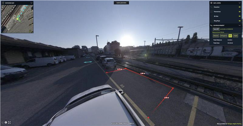
Hexagon’s LuciadRIA is a browser-based tool for desktop-like visualization and analytics of satellite and other imagery, vector-based data, and dynamic content, such as tracks. With the LuciadRIA 2020.1 release, available beginning 22 October 2020, panoramic images are brought into the 3D view as another information layer with no plugin or separate view panel. The new capability allows you to fully integrate panoramic images with any other information present in your 3D view and open multiple panoramic data sources in the same view.
For example, you can see buses moving though the street, get status updates of critical infrastructure items, and even combine panoramic imagery with other 3D datasets like terrain elevation, 3D models, and point clouds.
When 360° panoramic images are brought into an empty view, the experience is like a typical road-level view, where you see the inside of “information bubbles” and transition from one to the other as you navigate around an area with multiple 360° captures.
Storing and Streaming Your Panoramic Data
As part of the Luciad Portfolio 2020.1 release, the LuciaFusion server solution also now supports panoramic imagery.
Using LuciadFusion Studio, panoramic imagery in the formats E57 (ASTM E57 3D file format) and M3D (by Leica Pegasus scanners) is automatically recognized and discovered via the LuciadFusion crawling capability. After the data is discovered, it can be added to data products, prepared for serving, and streamed with a new OGC 3D Tiles- based protocol.
As a future-proof technology, LuciadFusion can also stream panoramic imagery in other formats – even if the format is your own. Just use the API to create your own cube maps by providing the camera-specific image parameters, sensor locations, and orientations.
The Luciad Portfolio 2020.1 Release
With the latest release, you’ll be able to move past the window; take a step outside, and see the world how it’s meant to be seen with support for 360° panoramic imagery.
LuciadFusion and LuciadRIA 2020.1 will be available beginning 22 October 2020. Learn more about both products on our website.
Be among the first to try the new panoramic features for yourself by joining our mailing list for the latest Hexagon product updates.
