


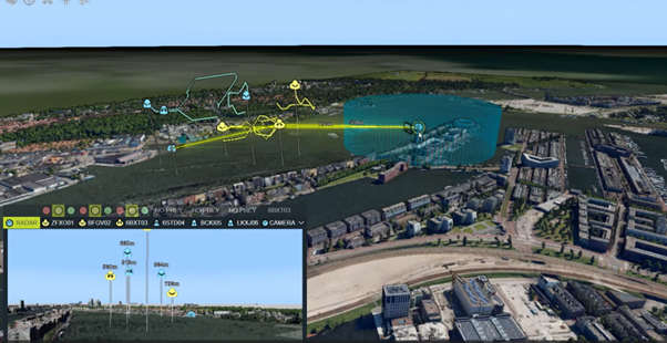
Various radar and video feeds are integrated in a single view, with military symbology and 3D visualization. A geospatial overview shows drones flying in a 3D model of a city. Those shown in blue are “friendly.” Those shown in yellow are unknown. Inset is a video feed from one of the drones in which we see what the drone is seeing. In the overview, we also see the radar installation in the blue/green area.
