What are your earliest memories of using a map? Chances are, your map was made of paper and perhaps kept folded up in a drawer somewhere in your home where it could be taken out occasionally for planning a trip. At the time, you did not expect changes to the map – such as new roads or neighborhoods – to be reflected until the next edition was released.
Maps weren’t updated very frequently in the past because, for one reason, acquiring the data took time. Although paper maps may have appeared first, aerial imagery was later taken (first from balloon and pigeon photography, and subsequently by airplanes) but even that didn’t happen very often for quite a while. Now, with satellites and drones that can operate just about continuously, imagery is created at an unprecedented pace. So today, the challenge is no longer to find the data, but to use it.
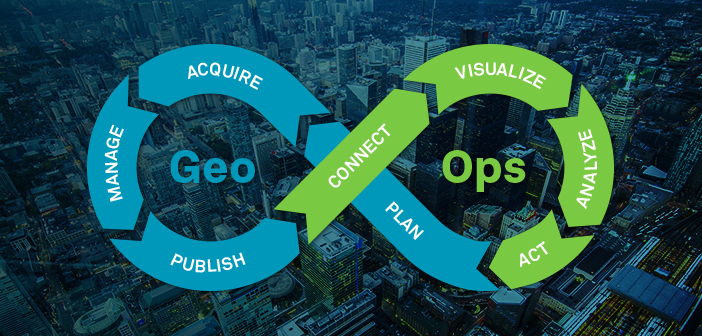
At Hexagon, we call this the “Geo-Ops Challenge,” and we mean that because Geospatial data can now be acquired so quickly, it needs to be handed off to support various operations just as quickly so decision-makers can visualize it, analyze it, and act on it. In short, the lifecycle loop from data acquisition to action needs to be dramatically shortened. This is Hexagon’s specialty, because our technology drastically shortens both workflows: Geospatial as well as Operations.
At HxGN LIVE 2019, Geospatial Division President Mladen Stojic discussed the connected ecosystems we are involved in, the ones that make up our sites, cities, and nations. In these ecosystems, we must bridge the divide between the geospatial and operational worlds to unlock the power of location intelligence and increase operational efficiency. Take a look.
Watch Mladen’s full 2019 keynote address, The Power of Connections.


