


If you’re new to the concept of applying AI, machine learning, deep learning, and algorithms to analyze and understand geospatial data, the meanings and implications of these terms can be a bit unclear. And even if you are familiar with these concepts, knowing when and how to apply them to geospatial data sets can be tricky.
In my last blog post on this topic, I explored how the geospatial industry and organizations can get the most out of AI, machine learning, and deep learning.
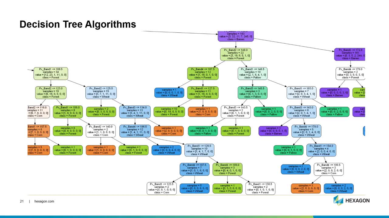
In Part 2 of my two-part video series, I will go deeper into machine and deep learning algorithms. I will discuss how they are uniquely different from each. And I will also provide some tips and tricks to help you understand which algorithms to use when and for what data sets.
To learn more, watch the video below.
Visit our website to learn more about remote sensing, machine learning, and location-based analytics.
