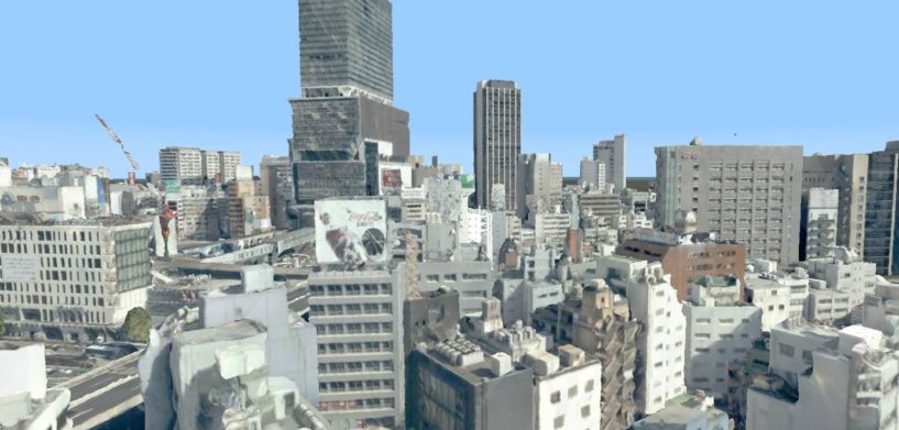
3D reality meshes are highly detailed representations of precise real-world environments. Buildings, bridges, and even entire cities can be generated, but the resulting 3D models are generally massive in size.
For smooth visualization, even when connecting to a remote data source, 3D models are best streamed as a feed of 3D tiles. The Open Geospatial Consortium (OGC) has defined a community standard for this: OGC 3D Tiles.
Luciad Portfolio products support the OGC 3D Tiles file format, but the results have sometimes been lacking. When the tile generation process, data format, or data structure have been suboptimal, the resulting visualization, too, has been less than perfect.
New tiling engine
Whether you’re working with datasets automatically created from photogrammetry/global matching/LiDAR, CAD/BIM data, or datasets based on a combination of imagery and cadastral parcel information (optionally combined with manually created 3D models), LuciadLightspeed 2020.0 and LuciadFusion 2020.0 are up for the task.
These new releases feature a 3D processing engine that optimizes 3D mesh datasets for streaming. The tiling engine takes as input any data converted into OBJ format. Making no assumptions on the structure of the data, it then cleans up data structures, splits the data into tiles, combines them, and applies simplification to create levels of detail. Texture atlases are generated, and the result is encoded as an OGC 3D Tiles-compliant dataset.
Real-world benefits of 3D models
3D models are widely used in a variety of industries, including the geospatial world. When they’re served by LuciadLightspeed 2020.0 and LuciadFusion 2020.0, users see a range of benefits:
- Streaming of multi-leveled data
- Data (meshes and textures) and metadata (level of detail, tree structure, location) modeled separately
- Support for point clouds
- Styling can be defined based on properties of the features
- The tile set can be heterogenous (i.e., meshes can be combined with point clouds)
- Freedom in tree structure and data content
Whether your 3D models are captured through photographic surveying, created in design modeling tools, or created via a combination of automated and manual modeling, the latest releases in the Luciad Portfolio are the best on the market for meeting your data-serving needs. Even if conditions aren’t ideal, your tiling and streaming experience will be.
Learn more about the Luciad Portfolio’s LuciadFusion server solution.


